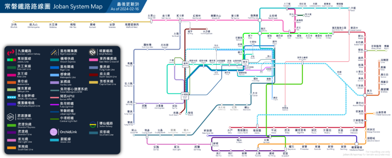
File:RouteMap.png
File on Joban Wiki
Views
Actions
Namespaces
Variants
Tools
Revision as of 16:39, 6 June 2023 by LX86 (talk | contribs) (LX86 uploaded a new version of File:RouteMap.png)

Size of this preview: 800 × 322 pixels. Other resolutions: 320 × 129 pixels | 640 × 257 pixels | 1,024 × 412 pixels | 1,280 × 515 pixels | 4,553 × 1,831 pixels.
Original file (4,553 × 1,831 pixels, file size: 1.21 MB, MIME type: image/png)
Licensing
File history
Click on a date/time to view the file as it appeared at that time.
(newest | oldest) View (newer 10 | older 10) (10 | 20 | 50 | 100 | 250 | 500)| Date/Time | Thumbnail | Dimensions | User | Comment | |
|---|---|---|---|---|---|
| 21:30, 7 April 2023 | 4,731 × 1,635 (817 KB) | LX86 (talk | contribs) | Close Tsing Lam Station | ||
| 20:29, 7 April 2023 | 4,731 × 1,635 (822 KB) | LX86 (talk | contribs) | Postpone opening | ||
| 01:39, 7 April 2023 | 4,731 × 1,635 (823 KB) | LX86 (talk | contribs) | Update System Map to reflect recent changes | ||
| 22:38, 6 April 2023 | 4,731 × 1,635 (712 KB) | LX86 (talk | contribs) |
You cannot overwrite this file.
File usage
The following 2 pages use this file: